Why Is A Tiny Michigan Carved In The Earth Up North?
In a rural section of Montmorency County, not far from Lewiston, there is an outline of Michigan carved into the earth. Here's why.
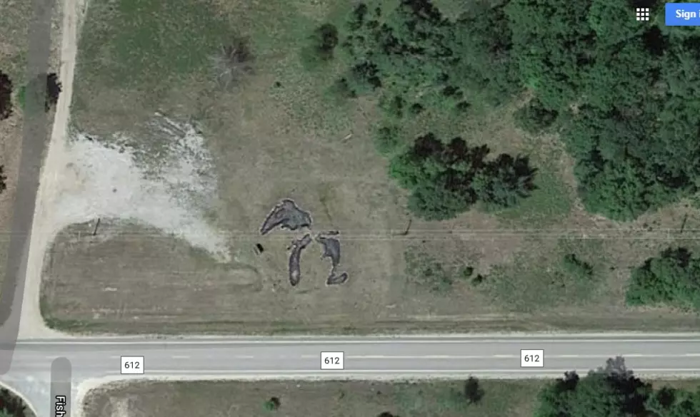
Just east of Lewiston along county road 612, right where it intersects at Fish Lab Road, is where the mini-Michigan is, and while the "Great Lakes" part of the carving are now empty, they once were little ponds of water.
The art work goes back to the the Great Depression when President Franklin Roosevelt created the Civilian Conservation Corps to put unemployed men back to work.
The CCC was responsible for constructing roads in Michigan, as well as maintaining forest lands and constructing state park facilities. According to the Michigan History Center, over 8000 men were employed by the CCC in camps throughout Michigan.
One of those camps was on county road 612. It was dubbed Camp Lunden, and according to Lost In Michigan, the engineers and workers living in the camp had lots of free time, so they built a little Michigan between projects.
A few months after Franklin Roosevelt created the CCC the camp was created outside of Lewiston and given the name Camp Lunden. It was one of 103 camps in Michigan. Men training to be draftsmen and civil engineers arrived. In their spare time, they dug the ponds created the shape of Michigan at the entrance. The camp closed in 1936 and only the ponds remain along with a historical marker to mark the spot where the CCC camp once stood.
So my next question would be, 'why is there a Fish Lab Road, and what did they do to the fish in the lab?'
I'll work on the answer for you.
40 Michigan Towns With Names Even Life-Long Michiganders Can't Pronounce
More From 99.1 WFMK